
Location is a fundamental aspect of our daily lives, influencing a multitude of decisions and actions. Whether we are navigating a city, conducting business, or simply socializing, the concept of location plays a pivotal role. A location is the specific spot or area where a particular point or object is situated. The term “location,” is derived from the Latin words “locatio, locationis” which refers to a specific place or position. The idea of the location could be as broad as atra city or as precise as a set of coordinates on the Earth’s surface. With advancements in technology, the concept of location has expanded to include virtual spaces, such as websites or digital platforms. In essence, a location is a reference point that helps us understand where something is situated in relation to its surroundings. The identification of location holds multifaceted significance across various domains. From the fundamental role in navigation, where GPS technology facilitates efficient travel on foot or by vehicles. It plays a critical role in emergency services, ensuring prompt assistance by accurately conveying one’s location. In the business domain, businesses leverage location data to tailor marketing strategies and optimize logistics.
A Bit From History
Since the dawn of human exploration, tracing location has been an intrinsic challenge met with ingenuity and resourcefulness. When considering the methods used by our ancestors to trace locations, celestial navigation is one of the earliest methods used by sailors and explorers. They relied on the position of the stars and celestial bodies to determine their location at sea. This ancient technique, practiced for centuries, laid the foundation for understanding geographical positioning. As civilizations developed, people began to rely on physical landmarks and maps for location tracking. Maps became intricate works of art, showcasing detailed landscapes and geographical features. With the invention of the compass, it revolutionized navigation. By pointing towards the Earth’s magnetic north, the compass provided people with a consistent reference for direction, enabling more accurate navigation across the land and the sea.
The ability to trace location has evolved significantly throughout human history, from ancient methods of navigation to the advanced technologies we have today.
Modern Technologies
When location is combined with the word technology it denotes the application of sensors and methodologies for identifying and computing the geographical coordinates of entities such as mobile devices, individuals, or objects. This integration of location and technology is commonly associated with the internet and in the present it is widely used by many industries to improve their technological perspectives.
GPS Technology
The most transformative leap in location tracing came with the advent of Global Positioning System (GPS) technology. In 1978 the first spacecraft was launched and it was originally named Navstar, which was the first main step to the GPS. It was developed and owned by the U.S. Department of Defense. In May 2000, it became fully functional and received the authorization to use for civil purposes free of charge. The GPS comprises over 30 navigation satellites orbiting Earth. These satellites continuously transmit signals, which are picked up by GPS receivers in devices like phones. By determining its distance from GPS satellites, the receiver can then calculate and identify the precise location. This method of calculating the location is called trilateration. From the known three or four distances, you can draw circles or spheres (according to 2D or 3D) whose radius represents the distances from the satellites while the origin of the circle becomes the satellite. The overlapping point gives you the location where the device is located. In 2D trilateration, the problem is solved in a two-dimensional plane. It calculates the latitude and longitude positions on a map. In 3D trilateration, the problem is solved in three-dimensional space, which gives the 3 position values latitude, longitude, and altitude. To calculate the location there should be 4 or more satellites connected to the receiver. The accuracy will be increased if the number of connected satellites increases. GPS doesn’t need an internet or phone signal to function properly. But with those signals and facilities, it will become more effective.
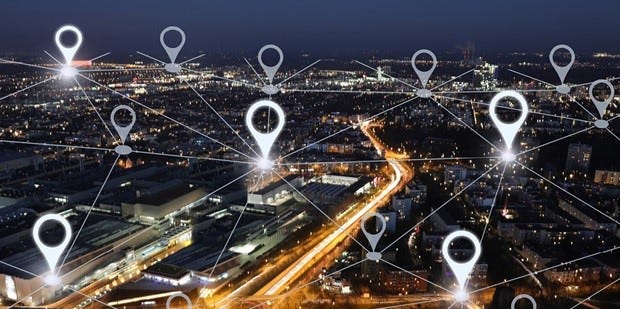
Image Credits: waterlooedc
Cell Tower Triangulation
Cell tower triangulation is a widely used method for determining the location of a phone or device. When a cell phone sends signals that are received by three or more nearby cell towers, triangulation comes into play. By identifying the overlapping point of these signals, the system can estimate the device’s location based on its distance from each tower. The cell towers broadcast their locations, and by calculating the phone’s distance from them, the coordinates of the device can be determined. The accuracy of this method typically ranges from 500 to 1500 meters, and in densely populated urban areas where towers are abundant, it becomes possible to pinpoint the location with greater precision.
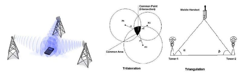
Image Credits: LinkedIn-boney-maundu | Researchgate — Decision Tree for Selection Appropriate Location Estimation Technique of GSM Cellular Network
Wi-Fi Location Positioning
Wi-Fi location positioning, also known as Wi-Fi positioning system (WPS/WiPS) is based on Wi-Fi hotspots and wireless access points. It is a method for identifying the geo-location, which is based on measuring the receiving signal strength. Instead of relying on satellites, like in GPS, it uses Wi-Fi routers and access points to pinpoint a device’s location accurately. Even when a device is not connected to a Wi-Fi router, it continuously sends and receives data to identify nearby routers. Therefore, as long as Wi-Fi is enabled in a device, the devices remain in constant communication. The background location service of the device which constantly seeks Wi-Fi access points, transmits the BSSID(MAC address) of the access point along with its location identified through GPS or cell tower triangulation to their respective servers. From it, the location can be tracked. Mostly this technology is used in indoor positioning, where the GPS doesn’t work accurately.
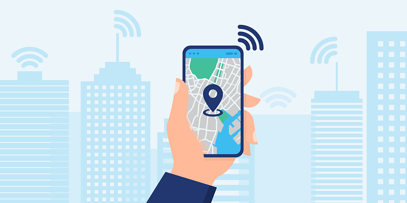
Image credits: vpnoverview
Bluetooth Location Positioning
Bluetooth is a wireless technology used for communicating short distances over short-wavelength radio waves between devices, with an accuracy between 1 and 2 meters. The most recent version called Bluetooth Low Energy (BLE) is built into many smartphones. Bluetooth positioning or Bluetooth location tracking, uses radio waves to locate a device. In this positioning system, sensors detect Bluetooth signals and measure their strength, while beacons transmit signals that can be used as reference points for making location assessments. Only by combining the collected data, systems can deliver accurate location and tracking services. By using this method, smartphones determine their location based on picking up signals from BLE beacons enabled in an indoor positioning system. This technology is also used in indoor positioning where short distance communication can be done.
IP Geolocation
IP Geolocation is the process of determining the geographic location of a device using the IP address. The way the IP-based geolocation works is simply by checking which IP range is used by which area, using an IP-to-location database. The information you get back could be as broad as what country the IP address is in, to as specific as a zipcode or a pair of coordinates.
IP-based geolocation typically offers reasonably accurate results. It can provide accuracy ranging from 55 percent to 80 percent when determining a user’s general region or state. When pinpointing a specific city, the accuracy usually falls within the range of 50 to 75 percent. It’s important to note that the actual level of accuracy can vary based on the geolocation service provider and the device’s location.
Comprehensive Location Determination
To get an accurate location, the previously mentioned methods can be combined and applied together. So if one method fails, the other methods can be used to find the location. For example, if a user is staying in a place where 4 satellites cannot be connected to the user’s device, the GPS will not work accurately. So it needs to rely on another method to identify the location. For that, cell tower triangulation or Wi-Fi location positioning methods can be used to determine the location.
Google provides a simple API that combines several methods to find the location accurately. The fused location provider is one of the location APIs in Google Play services, which manages the underlying location technology and provides a simple API so that a user can specify requirements at a high level, like high accuracy or low power. It intelligently combines different signals to provide the location information. The fused location service combines cell towers, Wi-Fi, and GNSS constellations seamlessly to determine a device’s location. This means that users and even application developers often don’t need to be aware of which technology is being employed at a given moment to pinpoint the device’s location.
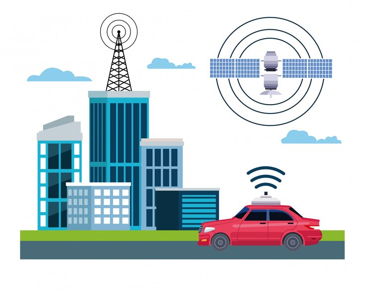
Image credits: FreePik
Future of Location Tracking
Visible Light Communication: The ongoing research in Visible Light Communication (VLC) systems seeks to enhance communication capabilities through the utilization of visible light. This technology, called Li-Fi, provides high-speed and effective data communication. Utilizing VLC, a specific application known as Visible Light Positioning (VLP) emerges, applying the inherent principles of VLC to determine the precise location of a device. VLP determines the position of a device by analyzing the light signals it receives from visible light sources.
AI-powered tracking: Presently, artificial intelligence is used to enhance tracking technology, with the anticipation that its efficacy will further intensify in the future. AI-powered tracking analyzes data in real-time for precise information. These algorithms influence historical data and environmental factors to enhance GPS tracking accuracy.
By incorporating machine learning techniques, GPS location tracking systems can continuously learn from data, adapt to changing conditions, and refine their location estimation algorithms, resulting in more precise tracking information.
One of the primary benefits of blockchain in spatial tracking is the ability to secure location data. With blockchain, location monitoring records can be stored in a decentralized manner across multiple nodes, making it nearly impossible for malicious actors to tamper with or alter the data.
Conclusion
In conclusion, the field of location tracking has evolved significantly, offering a variety of methods to determine a user’s position accurately. Recognizing the limitations of individual technologies, the integration of GPS, cell tower triangulation, and Wi-Fi positioning has become a sophisticated approach. This approach enhances accuracy as well as simplifies the user experience. As technology continues to advance, the combination of these methods ensures robust and reliable location tracking, providing diverse scenarios and environments. Furthermore, with the improvement of future technologies such as VLC and AI, whether in areas with limited satellite connectivity or urban landscapes with dense signal interference, the combination of these technologies ensures a flexible and effective solution for location-based applications and services.
References
(2022) Wi-Fi location tracking: How does it work? Available at: http://www.eviewgps.com:3001/newsDetails?id=39
Anwar, R. (2023) Bluetooth location tracking systems: Types and use cases: Eastern peak, Eastern Peak — Technology Consulting & Development Company. Available at: https://easternpeak.com/blog/bluetooth-location-tracking-systems/#:~:text=Bluetooth%20positioning%2C%20or%20Bluetooth%20location,out%20or%20receive%20those%20waves.
Blog, I. (2023) All you need to know about location technology [The ultimate guide], Incognia. Available at: https://www.incognia.com/the-authentication-reference/all-there-is-to-know-about-location-technology-the-ultimate-guide
Global Positioning System (2023) Wikipedia. Available at: https://en.wikipedia.org/wiki/Global_Positioning_System#:~:text=The%20GPS%20project%20was%20started,satellites%20became%20operational%20in%201993.
Porutiu, T. (2022) Wi-Fi location tracking: How does it work?, VPNOverview.com. Available at: https://vpnoverview.com/privacy/devices/wi-fi-location-tracking/
Safetrax. Available at: https://www.safetrax.in/how-gps-cell-tower-and-wi-fi-triangulation-help-in-tracking location#:~:text=Cell%20tower%20triangulation%20is%20another,enabling%20the%20triangulation%20to%20work.


About The Author: Tracified Admin
More posts by Tracified Admin